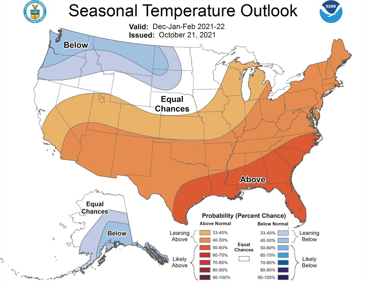
La Niña to impact winter weather conditions

Although the National Weather Service is predicting a normal amount of precipitation and normal temperatures for the upcoming winter months, students and staff should prepare for cold weather to begin earlier than last year.
This year will be a La Niña year, meaning colder waters in the eastern Pacific Ocean near the equator will make temperatures in the Midwest colder, according to Peter Rogers, the warning coordination meteorologist from the Sioux Falls National Weather Service.
During a La Niña year, the jetstream comes further south, allowing colder air to enter the Northern Plains. Areas like Western South Dakota, North Dakota and Montana will likely be colder and have heavier snowfall than typical years.
Sioux Falls should have temperatures that average at around 40 to 45 degrees Fahrenheit with around 40 inches of snowfall from late December to mid March.
“That doesn’t necessarily mean every day is going to be like that. What that means is once the winter is over and you average everything out, more than likely we’re going to be near normal temperatures and near normal precipitation,” said Phil Schreck, the chief meteorologist at Dakota News Now.
Rogers also said weather can vary greatly by individual location. One city can have much more snow than another with the entire region still having average amounts of precipitation
“Snowfall can be highly variable from one location to the next, just like thunderstorms and rainfall can be in the summer,” Rogers said.
While last winter averaged normal temperatures and participation rates, December and January were above normal levels. A February cold snap was responsible for averaging it out. This year, South Dakota residents should expect the weather to grow colder earlier.
To keep campus safe during the winter months, Rick Tupper, the associate vice president for campus safety and logistics, will communicate with students, faculty and staff by putting out weather reminders, plowing notices and class alterations.
For Tupper, ice on the roads is more concerning than snowfall. While snow can affect visibility and can be problematic when it accumulates, ice makes commuting to class dangerous.
Campus safety works with the National Weather Service to monitor weekly weather to plan and prepare for ice or snow events. Tupper usually decides whether or not to alter classes early in the morning.
“You’re in the best position to decide what’s safe for you,” Tupper said. “No matter what my decision is, if you look out the door and it’s not safe, then you shouldn’t go outside no matter what I’ve said.”
Campus safety opens the Elmen Center parking lot for students who live in nearby neighborhoods and park on city streets when the city needs to plow. Tupper tries to send out notices early when students will need a place to keep their vehicles. Campus safety will also jump start students’ cars if their batteries die.
Students are advised to keep an emergency kit in their cars in case they become stranded during a storm and to let people know when they are traveling in case of an emergency. Kits can include food, water and blankets among other supplies.


